Harry Potter and the “Marauder’s Map”
Can this magical map be realized technically?

In the Harry Potter movie “Harry Potter and the Prisoner of Azkaban” (Warner Bros. Entertainment), the “Marauder’s Map” charts where everybody in the Hogwarts School of Witchcraft and Wizardry is at any one moment. Bosch expert Kejia Wang explains whether a comparable map could actually work in our non-magical world.
Harry Potter
The Harry Potter story has been read by millions and the Hogwarts universe of witchcraft and wizardry has become world famous. With the help of his two best friends, Hermione and Ron, and all kinds of magical creatures and objects, Harry takes on the dark Lord Voldemort and his followers who want to gain control of the world of witches and wizards. The “Marauder’s Map” is one of Harry’s best-known tools and first appeared in “Harry Potter and the Prisoner of Azkaban” (Warner Bros. Entertainment). All those touching the map with a wand while uttering the magic words “I solemnly swear that I am up to no good” will see the actual positions of everybody present in Hogwarts and the directions they are heading. Harry and his friends use the map, for example, to avoid meeting people they want to keep clear of when discovering hidden rooms or when sneaking out of the school grounds at night.

Yes, such a map really is possible with a combination of a special algorithm and sensors.
Principle from seafaring
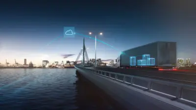
An essential part of the technology is the interaction between software and motion sensors which, in turn, could transfer the “Marauder’s Map” to our “Muggle World.” Wang explains: “Devices equipped with the technology can determine your position and then send it to a receiver whereby you are made visible on a digital map.” Real time movement can also be seen. The basic principle of the technology originally stems from seafaring where the so-called “dead reckoning“ has been applied for centuries now.
Whenever a ship’s position was known but navigation was made impossible by clouds or fog obscuring the starry sky, the sailors lowered a wooden board weighed down by lead that was attached to a line with a number of knots at uniform intervals. After a certain period of time, the line was reeled in and the speed was calculated by means of the number of knots that passed through the sailor’s hands within a given time. The direction was established using a compass. All the data was then combined with the speed and the sailors could determine where they were on the map.

Conserving the battery
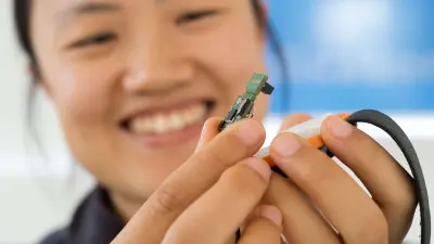
These days, Bosch uses Pedestrian Dead Reckoning Software (PDR) for everyday uses such as making orientation easier for joggers or tourists with the help of wearable devices like a smartwatch. “For it to work, one has to carry certain sensors and a PDR algorithm,” explains Kejia Wang. Together with other software specialists in her team, she has developed a sensor that is small enough to even fit into a smartwatch. The so-called Position Tracking Smart Sensor BHI160BP determines one’s position not only outdoors but also indoors — a big advantage over GPS signals that are often very weak inside buildings.
This is where Bosch’s PDR system is particularly strong: To determine positions, it does not need continual Wi-Fi or GPS. As soon as the device establishes where it is situated, it carries out the additional positioning using a gyroscope and accelerometer. The Smart Sensor measures the movement of its wearer to localize itself. It is made possible by the algorithm developed by Bosch; it calculates the position using the direction in which one is running, the stride length, and the time taken. The minimal power consumption is another key advantage of the system: “As the positioning is no longer done by a global navigation satellite system alone but with the help of built-in motion sensors, the Smart Sensor uses up to 80 per cent less power than conventional GPS devices,” points out Wang. It conserves the battery and is therefore very useful, especially in devices with small batteries.
Magic in daily life
The possible applications of the Position Tracking Smart Sensor are numerous. In sports, it can be used in smartwatches and fitness trackers. With the help of the system, wearers could also chart their location in museums or shopping malls on a virtual map. Companies could, for example, hand out a PDR system with sensors to external visitors whose positions are checked for security reasons. The PDR can do even more than the “Marauder’s Map”: While Harry Potter can only see in which direction a person is heading, the Smart Sensor can ascertain whether they are walking, running, or standing still after evaluating the sensor data.
Profile

Kejia Wang, Systems Engineer at Bosch Sensortec
Kejia Wang studied biomedical engineering at the University of Auckland in New Zealand until 2012 and gained a doctorate in biomedical engineering at the University of New South Wales in Sydney, Australia in 2018. Wang joined Bosch Sensortec in 2017. She works as a developer of software for sensor data fusion and has been supporting the team developing Pedestrian Dead Reckoning Software since the start of 2018.
Summary
Science fiction? No, science fact: The “Marauder’s Map” from “Harry Potter and the prisoner of Azkaban” (Warner Bros. Entertainment) is not wizardry — it is technically possible. Instead of GPS-only, the Bosch solution involves combining GPS and a PDR algorithm with motion sensors. The system also functions indoors, saves energy and does not require a permanent Wi-Fi or GPS connection.